Resources
This page contains some key resources on walking and cycling, including an archive of the documents produced by the Australian Bicycle Council.
| Date Added | |||
|---|---|---|---|
 |
Tasmanian Cycling Infrastructure Design Guide Department of State Growth, Tasmania The Tasmanian Cycling Infrastructure Design Guide has been developed to support the design of infrastructure, in particular on-road treatments, that enable more people to ride. This can be new cycling infrastructure, or upgrades to existing routes. The guide seeks to complement existing guidance (such as Austroads) to achieve better design outcomes that respond to the local context. The principles and treatments in the guide are applicable throughout Tasmania. The guide draws on national and international best practice and some of the concepts introduced are new to Tasmania. |
16/09/2024 | View |
 |
Safer cycling infrastructure: Design and policy Transport for NSW iMOVE’s Safer cycling and street design: A guide for policymakers project was a two-year investigation with Transport for NSW (TfNSW) and the University of NSW on how to best integrate cycling into urban and suburban environments in order to interest more people in that mode of transport, addressing their concerns about safety. |
22/07/2024 | View |
| Transport Access Strategy Department of State Growth The Transport Access Strategy sets out the Tasmanian Government’s approach to providing better integrated and coordinated land-based passenger transport services for all Tasmanians, particularly those disadvantaged through economic circumstances, age or disability. The strategy aims to improve social connectivity and access to employment (paid and voluntary), training and education, services and recreational opportunities by focusing on progressing the following priority areas:
|
27/05/2024 | View | |
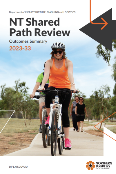 |
Northern Territory shared path network reviews Department of Infrastructure, Planning and Logistics (DIPL), Northern Territory The Department of Infrastructure, Planning and Logistics (DIPL) has completed a review of Northern Territory Government (NTG) owned shared paths across Greater Darwin, Katherine, Tennant Creek and Alice Springs. The review is key to continuing strategic development of shared paths in line with stakeholder and community needs for the next 10 years. The purpose of the review was to assess the existing NTG shared path networks and provide recommendations for:
A number of key considerations guided the review including efficiency, safety and connectivity. |
11/12/2023 | View |
 |
Universal access Department of Transport and Main Roads, Queensland On this page: |
27/10/2023 | View |
 |
Speed management and integrated treatments Department of Transport and Main Roads, Queensland On this page: |
27/10/2023 | View |
 |
Road crossings Department of Transport and Main Roads, Queensland On this page: |
27/10/2023 | View |
 |
Paths for walking Department of Transport and Main Roads, Queensland On this page |
27/10/2023 | View |
 |
Pedestrian and Walking Guidance: Supporting facilities Department of transport and Main Roads, Queensland On this page: |
27/10/2023 | View |
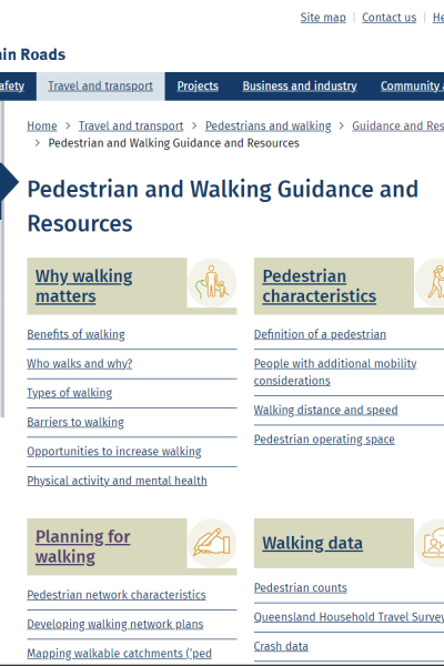 |
Pedestrian and Walking Guidance and Resources Department of Transport and Main Roads, Queensland Including:
|
13/10/2023 | View |
 |
Active Travel to School Program: School Transport Infrastructure Program Department of Transport and Main Roads, Queensland PROGRAM FEATURES: Funding to improve the safety and operation of schools through new or improved infrastructure at the school and/or on the surrounding road network. E.g.:
DATE IMPLEMENTED: Not available COST OF PROGRAM: Not available. Grants up to $500,000 available COST TO USER: Funding usually provided on a 50:50 subsidy basis, e.g. co-funding between Department of Transport and Main Roads and local government RESULTS OF EVALUATION: Not available |
28/02/2023 | View |
|
Active Travel to School Program: Active Streets for Schools (ACT) Transport Canberra and City Services PROGRAM FEATURES:
DATE IMPLEMENTED: 1 July 2015 COST OF PROGRAM: $500,000 per year COST FOR USERS: None ADDITIONAL INFORMATION: Infrastructure improvements include a combination of upgrades to existing infrastructure and new works, focusing on paths, crossings and treatments to slow vehicle speeds. Blue stencils are installed along paths to provide wayfinding signage to local schools. The stencils give families the peace of mind the route to school is safe and easy to follow. The stencils promote:
Part of program incorporating training and other resources (Ride or Walk to School), and safety at school crossings (School Crossing Supervisors) to encourage children to use active travel to get to and from school. RESULTS OF EVALUATION: Report |
09/01/2023 | View |
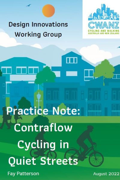 |
CWANZ Design Innovations Working Group Practice Note: Contraflow Cycling in Quiet Streets CWANZ The CWANZ Design Innovations Working Group undertook a review of contraflow cycling lanes in quiet streets. This report presents the evidence, technical advice, and implementation and design. Examples of streets with contraflow cycling lanes in Australia and New Zealand are given. |
06/10/2022 | View |
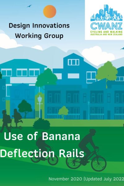 |
CWANZ Design Innovations Working Group: Use of Banana Deflection Rails CWANZ The CWANZ Design Innovations Working Group undertook a review of the use of banana deflection rails (banana bars) in Australia. In undertaking this review, they considered the Traffic and Road Use Management Volume1–Guide to Traffic Management Part 6: Intersections, Interchanges and Crossings (2020) prepared by the Queensland Department of Transport and Main Roads (TMR), and Municipal Infrastructure Standards (MIS) 05 – Active Travel Facilities Design, prepared by Transport Canberra City Services (TCCS). |
12/07/2022 | View |
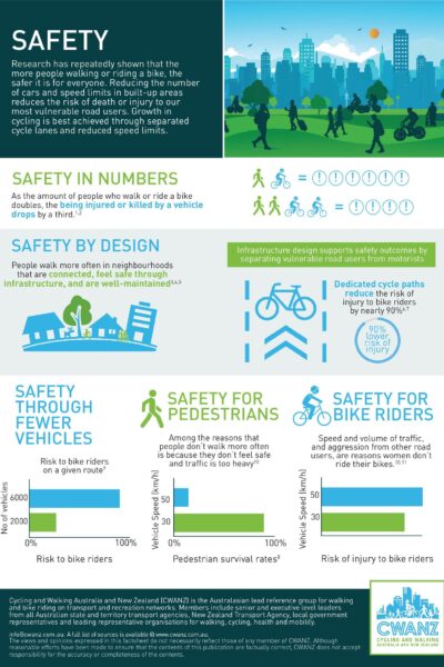 |
CWANZ Fact Sheet: Safety CWANZ Research has repeatedly shown that the more people walking or riding a bike, the safer it is for everyone. Reducing the number of cars and speed limits in built-up areas reduces the risk of death or injury to our most vulnerable road users. Growth in cycling is best achieved through separated cycle lanes and reduced speed limits. |
28/04/2022 | View |
 |
NSW State Infrastructure Strategy Infrastructure NSW The State Infrastructure Strategy is a 20-year infrastructure investment plan for the NSW Government that places strategic fit and economic merit at the centre of investment decisions. The strategy assesses infrastructure problems and solutions, and provides recommendations to best grow the State's economy, enhance productivity and improve living standards for our NSW community. It is updated every five years. |
12/04/2022 | View |
 |
Why do cyclists infringe at red lights? An investigation of Australian cyclists’ reasons for red light infringement Accident Analysis & Prevention This study investigated the behavioural, attitudinal and traffic factors contributing to red light infringement by Australian cyclists using a national online survey. The survey was conducted from February to May 2010. In total, 2061 cyclists completed the survey and 37.3% reported that they had ridden through a signalised intersection during the red light phase. The main predictive characteristics for infringement were: gender with males more likely to offend than females (OR: 1.54, CI: 1.22–1.94); age with older cyclists less likely to infringe compared to younger cyclists 18–29 years (30–49 yrs: OR: 0.71, CI: 0.52–0.96; 50+ yrs: OR: 0.51, CI: 0.35–0.74), and; crash involvement with cyclists more likely to infringe at red lights if they had not previously been involved in a bicycle–vehicle crash while riding (OR: 1.35; CI: 1.10–1.65). The main reasons given for red light infringement were: to turn left (32.0%); because the inductive loop detector did not detect their bike (24.2%); when there was no other road users present (16.6%); at a pedestrian crossing (10.7%); and ‘Other’ (16.5%). A multinomial logistic regression model was constructed to examine the associations between cyclist characteristics and reasons for infringement. Findings suggest that some cyclists are motivated to infringe by their perception that their behaviour is safe and that infrastructure factors were associated with infringement. Ways to manage this, potentially risky, behaviour including behaviour programmes, more cyclist-inclusive infrastructure and enforcement are discussed. |
12/04/2022 | View |
 |
Research report 440 Reducing pedestrian delay at traffic signals Waka Kotahi NZ Transport Agency Since 2000, the benefits of walking as a mode of travel have been recognised by the New Zealand government in a raft of policy statements and strategies. However, the Ministry of Transport acknowledges that there are a number of issues to overcome to encourage more walking. This research focuses on one of the key issues: namely, the delay experienced by pedestrians at traffic signals. Historically, New Zealand's approach to pedestrian delay has been minimal, with pedestrian issues considered primarily from the point of view of safety, rather than level of service or amenity. At traffic signals, pedestrians are often accommodated in a way that causes the least amount of interruption to motorised traffic, and signal cycle times can be long, leading to excessive pedestrian waiting times. This can lead to frustration, causing pedestrians to violate the signals and use their own judgement to cross, resulting in safety risks. This research, which was carried out between 2007 and 2010 in Auckland, Wellington and Christchurch, used techniques such as pedestrian attitude surveys, micro-simulation modelling and a literature review of international best practice to identify methods of reducing pedestrian delay at signalised intersections in these cities. The recommendations developed during the course of the research provide both technical and policy mechanisms for improving pedestrian delay in New Zealand's central-city areas. |
07/04/2022 | View |
 |
Research report 436 Benefits of new and improved pedestrian facilities - before and after studies Waka Kotahi NZ Transport Agency Walking is an essential mode of transport. New and improved pedestrian facilities promote walking and provide greater access and mobility within our communities. The NZ Transport Agency has recently updated the procedures for the evaluation of pedestrian improvement projects. The benefit factor applying to new pedestrian trips was increased from $0.50 to $2.70/km, making pedestrian facility improvement projects more economically viable. Thus, estimating the increase in pedestrian flows (as opposed to simply recording existing pedestrian flows) is now important in the economic evaluation of new or improved facilities. This research analysed case studies at eight New Zealand sites where the implementation of new pedestrian facilities (or the improvement of existing facilities) led to increased pedestrian usage and improved perception of the sites. The study recorded pedestrian rates both before and after facility implementation, and analysed accompanying factors such as safety, delay and directness. It also tried to develop an expected pedestrian-usage model, based on before and after data analysis, for planners and funding agents to use when planning new or improved facilities, and for use in project evaluation. Finally, a monitoring database containing before and after pedestrian count data for various new and improved pedestrian facilities, along with a list of the accompanying factors mentioned above, was developed for future use. |
07/04/2022 | View |
 |
Research Report 431 The mechanisms and types of non-motor vehicle injuries to pedestrians in the transport system and indicated infrastructure implications Waka Kotahi NZ Transport Agency Research carried out in 2008-2010 examined the quantum and causes of non-motor vehicle injuries to pedestrians through a structured interview survey. Pedestrians sustaining injuries in locations away from the road network (eg in parks) were excluded, as the emphasis was on the role of road and footpath features. The highest proportion of trips and falls (34%) was sustained while stepping over a kerb. A further 18% were caused by irregularities in the path or road surface. Factors that amplified the severity of injuries included the road or path surface, pedestrians' inattention, type of footwear worn, and whether walking or running. Two main issues were identified from the study. These were:
The study recommends improving the definition of kerbing in key pedestrian areas and improving the maintenance regime of footpaths and roads used by pedestrians, eg crossings. The study also found that it is necessary to instigate research to provide improved data and analysis tools to prioritise such countermeasures vis-a-vis other uses of road safety funds and improved data for input into such analysis tools. Further, a national guide is needed for pedestrian road safety audits and inspections covering both motor vehicle and non-motor vehicle risk. |
07/04/2022 | View |
 |
Research report 428 Trialling pedestrian countdown timers at traffic signals Waka Kotahi NZ Transport Agency The overall research objective was to evaluate changes in pedestrian safety and traffic efficiency from installing pedestrian countdown timers. The study analysed pedestrian behaviour and safety before and after the installation of a trial countdown timer at the intersection of Queens Street, Bunny Street and Margaret Street in Lower Hutt in July 2007. The results were compared with the 2006/07 trial at the Queen Street/Victoria Street intersection in Auckland CBD and showed very different results. The Auckland city trial indicated that, if placed in suitable locations, pedestrian countdown signals were associated with pedestrian behaviour change that enhanced safety. This study in Lower Hutt demonstrated that the observed pedestrian safety decreased as the percentage of both late starters and late finishers increased, although this was likely to be due to the nature of the intersection with one particularly long diagonal crossing coupled with the allocated phase times. In contrast, perceived pedestrian safety increased with the installation of the countdown timers. |
07/04/2022 | View |
 |
Traffic control devices manual (TCD manual) Waka Kotahi NZ Transport Agency The Traffic control devices manual (TCD manual) provides guidance on industry best practice, including, where necessary, practice mandated by law in relation to the use of traffic control devices. |
07/04/2022 | View |
 |
Tactical Urbanism Handbook Waka Kotahi NZ Transport Agency The draft Tactical Urbanism Handbook has been developed as a tool to help councils and communities deliver tactical urbanism projects to a high standard, using a collaborative best-practice approach. |
07/04/2022 | View |
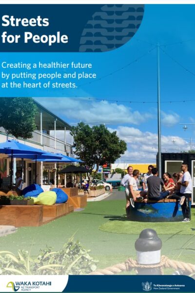 |
Streets for People Waka Kotahi NZ Transport Agency Creating a healthier future by putting people and place at the heart of our streets. |
07/04/2022 | View |
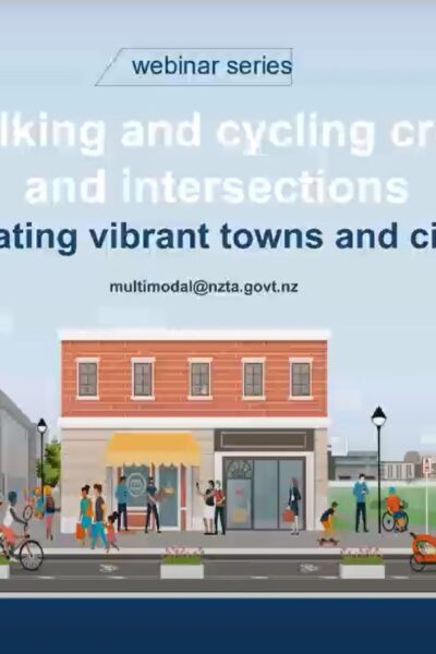 |
Safe walking and cycling treatments for intersections and crossings Waka Kotahi NZTransport Agency Waka Kotahi NZTransport Agency and the Transportation Group are hosting a series of free webinars focused on creating vibrant towns and cities. This webinar aims to introduce some of the current state-of-the-art thinking around these safety measures for our active modes. For more information on the ‘Creating vibrant towns and cities’ webinar series, visit www.nzta.govt.nz/creating-vibrant-towns-and-cities |
07/04/2022 | View |
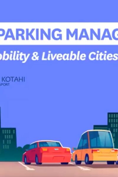 |
Strategic Parking Management Waka Kotahi NZ Transport Agency Part of Urban Mobility & Liveable Cities Series. Presented by Lorelei Schmitt, Principal Multimodal Advisor, Waka Kotahi NZ Transport Agency and George Lyons |
07/04/2022 | View |
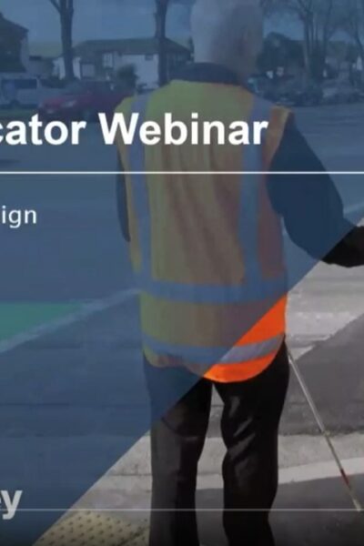 |
Tactile Indicator Installation Note - webinar Waka Kotahi NZ Transport Agency This webinar is for anyone involved in the design, installation and construction supervision of tactile ground surface indicators (TGSIs/tactile paving). |
19/10/2021 | View |
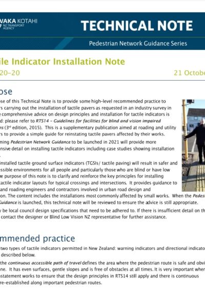 |
Tactile Indicator Installation Note Waka Kotahi NZ Transport Agency The purpose of this technical note is to provide some high-level recommended practice to contractors carrying out the installation of tactile pavers as requested in an industry survey in 2018. This is a supplementary publication aimed at roading and utility contractors to provide a simple guide for reinstating tactile pavers affected by their works. |
19/10/2021 | View |
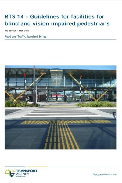 |
RTS14 Guidelines for facilities for blind and vision impaired pedestrians Waka Kotahi NZ Transport Agency RTS 14 is the official guide that ensures that design and operation of roads and paths caters for blind and vision impaired pedestrians. It also takes into account the needs of people with impaired mobility. It provides detailed requirements for a continuous accessible path, tactile ground surface indicators and audible tactile traffic signal features. |
19/10/2021 | View |
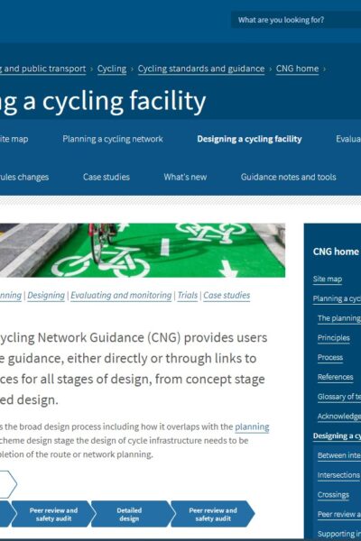 |
Designing a Cycling Facility Waka Kotahi NZ Transport Agency Provides users with best practice guidance, either directly or through links to appropriate sources for all stages of design, from concept stage through to detailed design |
19/10/2021 | View |
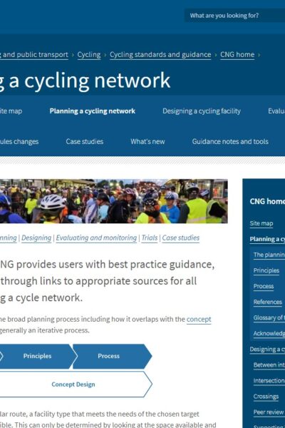 |
Planning a Cycling Network Waka Kotahi NZ Transport Agency Provides users with best practice guidance, either directly or through links to appropriate sources for all stages of planning a cycle network |
19/10/2021 | View |
 |
Technical note #4: Buffered Cycle Lane Design Waka Kotahi NZ Transport Agency Guidance on the design of buffered cycle lanes for varying carriageway widths |
19/10/2021 | View |
 |
Technical note #2: Separated Cycleways at Side Roads and Driveways Waka Kotahi NZ Transport Agency This updated guidance covers how to design a priority-controlled cycle crossing of a side road or driveway |
19/10/2021 | View |
 |
Technical note #1: Separated Cycleway Options Tool Waka Kotahi NZ Transport Agency Guidance on use of the Separated cycleway options tool (SCOT), used to assist in the decision on whether to provide two 1-way facilities or a single 2-way facility on a particular route |
19/10/2021 | View |
 |
Buffered Advance Stop Box Waka Kotahi NZ Transport Agency Provides a treatment solution for advance stop boxes to improve visibility of cyclists from heavy vehicles and decrease the level of vehicle encroachment |
19/10/2021 | View |
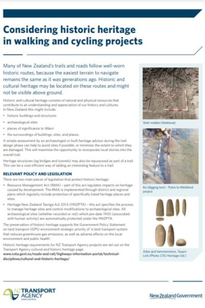 |
Considering Historic Heritage in Walking and Cycling Projects Waka Kotahi NZ Transport Agency The draft Handbook for tactical urbanism has been developed as a tool to help councils and communities deliver tactical urbanism projects to a high standard, using a collaborative best-practice approach. |
07/10/2021 | View |
 |
Draft Handbook for Tactical Urbanism in Aotearoa Waka Kotahi NZ Transport Agency The draft Handbook for tactical urbanism has been developed as a tool to help councils and communities deliver tactical urbanism projects to a high standard, using a collaborative best-practice approach. |
06/10/2021 | View |
 |
Shared and Separated Path Guidelines Department of Transport WA This document provides practitioners with guidance surrounding the planning and design of shared and separated paths in Western Australia to enable the safe and efficient movement of bicycle riders of all ages and abilities. It is intended to be a convenient and practical reference guide aimed at practitioners with varying levels of experience. |
06/10/2021 | View |
 |
Draft Handbook for tactical urbanism in Aotearoa - Guidance: roadway art Waka Kotahi NZ Transport Agency A supplement to the Handbook for tactical urbanism provides draft guidance on compliant application of using road artwork effectively and safely in New Zealand. |
30/09/2021 | View |
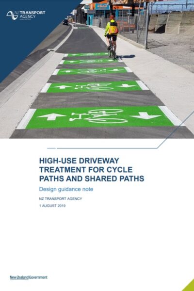 |
High-use driveway treatment for cycle paths and shared paths Waka Kotahi NZ Transport Agency Provides a treatment solution for commercial and high-use access points on cycleways and shared paths. |
30/09/2021 | View |
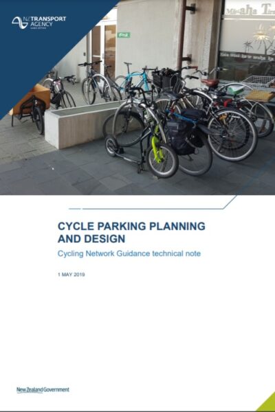 |
Cycle Parking Planning and Design Waka Kotahi NZ Transport Agency This guidance summarises best practice provision of parking and end-of-trip facilities for people who cycle. |
30/09/2021 | View |
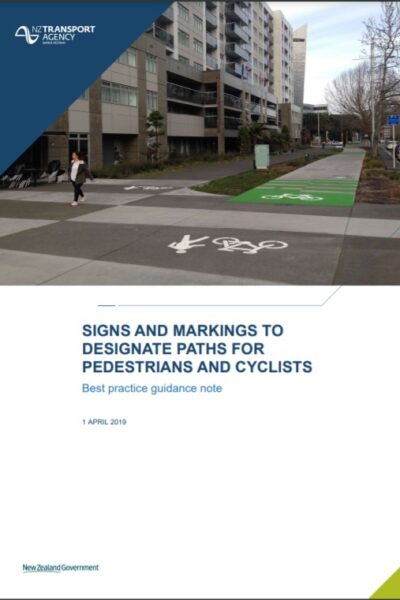 |
Signs and markings to designate paths for pedestrians and cyclists Waka Kotahi NZ Transport Agency Guidance on where and how to use markings and/or signs that designate paths for pedestrians and/or cyclists. |
30/09/2021 | View |
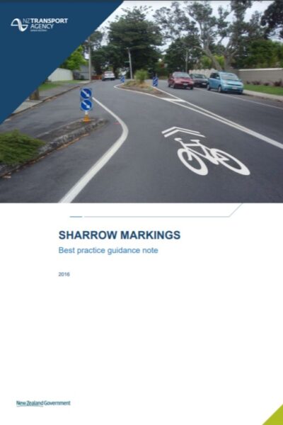 |
Sharrow Markings Waka Kotahi NZ Transport Agency Guidance on the implementation of shared lane markings (‘sharrows’). |
30/09/2021 | View |
 |
Cycle Facility Cost Estimation Tool Waka Kotahi NZ Transport Agency Tool to calculate and compare the rough order cost of a range of cycle route, facility and signalised intersection options. |
24/09/2021 | View |
 |
Cycleway Separation Device Selection Matrix Waka Kotahi NZ Transport Agency Matrix comparing types of cycleway separation device, and issues to be considered. |
24/09/2021 | View |
 |
Separated Cycleway Options Tool Waka Kotahi NZ Transport Agency Tool to assist in the decision on whether to provide two 1-way facilities or a single 2-way facility on a particular route. |
21/09/2021 | View |
 |
Design Guidance for Pedestrian and Cycle Rail Crossings Waka Kotahi NZ Transport Agency Waka Kotahi NZ Transport Agency and KiwiRail have been leading the development of a design guide for pedestrian and cycleway treatment at level crossings. The guide will improve safety, usability, compliance, consistency and will simplify the design process. |
21/09/2021 | View |
 |
Research Report 660: Factors affecting cycling levels of service Waka Kotahi NZ Transport Agency This report examines cyclists’ perceptions of cycle infrastructure levels of service and proposes an assessment methodology for evaluating the level of service provided by cycling facilities. |
03/09/2021 | View |
 |
Cycle Route Directional Signage Example Department of Infrastructure, Energy and Resources An example of the process that can be used to map and plan the direction signs required to navigate along a cycle route. The example used is the Battery Point section of the Sandy Bay to Hobart and return route. |
30/07/2021 | View |
 |
Cycle Route Directional Signage Resource Manual Department of Infrastructure, Energy and Resources As part of the implementation of the Walking and Cycling for Active Transport Strategy 2010, this document aims to provide a resource for cycle infrastructure owners to utilise when developing and implementing directional signage for cycle routes. |
30/07/2021 | View |
 |
City Plan ACT Government This City Plan sets a vision for future development in the city centre and was officially launched in March 2014. |
20/07/2021 | View |
| Building an Integrated Transport Network - Active Travel Transport Canberra and City Services The ACT Government's Building an Integrated Transport Network (the Active Travel Framework) recognises that walking and cycling are essential parts of Canberra's transport system. Through active travel initiatives, we're integrating walking and cycling into Canberra's overall urban planning, transport, health, environment and education systems. |
19/07/2021 | View | |
 |
New Paths on New Projects Department of Transport, Victoria Every major new transport project – from North East Link to the West Gate Tunnel – now includes new or upgraded infrastructure for cyclists and pedestrians. |
16/07/2021 | View |
|
Active Transport Victoria Department of Transport, Victoria The Victorian Government has committed $15.3 million in the Victorian Budget 2019/20 towards Active Transport Victoria projects to deliver key upgrades for safer walking and cycling. |
16/07/2021 | View |
|
St Kilda Road Bike Lanes Department of Transport, Victoria St Kilda Road will soon be safer for everyone with new bike lanes to be built to separate drivers and cyclists. |
16/07/2021 | View |
|
Safer CBD Cycling Connections Department of Transport, Victoria 100kms of new and improved cycling routes across key inner-city suburbs to make it easier and safer for people to cycle to and from the CBD. |
16/07/2021 | View |
 |
Strategic Cycling Corridors Department of Transport, Victoria Strategic Cycling Corridors are important transport routes for cycling and are a subset of the Principal Bicycle Network. |
16/07/2021 | View |
| Sydney CBD to Parramatta Strategic Transport Plan Transport for NSW The Sydney CBD to Parramatta Strategic Transport Plan is a transport plan to improve the way people move along and around one of Sydney’s most important and busiest areas, the corridor between Sydney CBD and Parramatta. |
15/07/2021 | View | |
 |
Greenways and Bike Boulevards Department for Infrastructure and Transport, South Australia Greenways are dedicated walking and cycling routes following public transport corridors or linear open space, such as along rivers. |
15/07/2021 | View |
 |
10 Year Infrastructure Plan 2019 Department of Infrastructure, Planning and Logistics, NT The reviewed Plan aims to help industry with its own planning and workforce management, and inform decision-making across all levels of government. Over the longer term, the Infrastructure Plan sets direction for planning and delivering infrastructure in the Northern Territory. |
13/07/2021 | View |
|
Cycling Infrastructure Grants Department of Transport and Main Roads, Queensland The Queensland Government is committed to achieving the Queensland Cycle Strategy 2017-2027 vision of ‘more cycling, more often on safe, direct and connected routes. The Department of Transport and Main Roads works with local governments to achieve this vision by delivering and improving principal cycle networks across Queensland. |
08/07/2021 | View |
 |
Principal Cycle Network Plans Department of Transport and Main Roads, Queensland Principal Cycle Network Plans show core routes needed to get more people cycling more often. Routes shown are indicative and exist to guide further planning. The plans are intended to support, guide and inform the planning, design and construction of the transport network. Read the Queensland Principal Cycle Network Update - Results of 2022 Community Consultation report to learn more about the consultation process and feedback received. |
08/07/2021 | View |
 |
Cycling Infrastructure Policy (Queensland) Department of Transport and Main Roads, Queensland The Cycling Infrastructure Policy is an important mechanism to deliver the Queensland Government’s vision for more cycling, more often and Transport and Main Roads’ vision of a single integrated transport system accessible to everyone. |
07/07/2021 | View |
|
Reporting a hazard or crash Department of Transport, WA Timely reporting of hazards from the community is vital to maintaining our cycling infrastructure. Find out what hazards to report and how to do so. |
07/07/2021 | View |
 |
WA Bicycle Network Plan Department of Transport, WA The WABN Plan aims to make WA a place where cycling is safe, connected, and convenient and a widely accepted form of transport. |
06/07/2021 | View |
|
Safe Active Streets Program Department of Transport, WA An innovative program designed to make streets, friendlier and safer for all users including people in cars and those riding bikes and walking. |
06/07/2021 | View |
 |
Australasian Pedestrian Crossing Facility Selection Tool Austroads The Pedestrian Facility Selection Tool is designed to help Australian and New Zealand practitioners select the most appropriate type of pedestrian crossing based on walkability, safety and economic outcomes. |
20/05/2021 | View |
 |
Walking Space Guide Transport for NSW The Walking Space Guide (Guide) provides a set of standards and tools to assist those responsible for Walking Spaces on streets, to ensure that sufficient space is provided to achieve comfortable environments which encourage people to walk. The Guide offers a clear, consistent set of standards and processes to be applied in designing, planning and implementing the amount of space to be provided according to the intensity of use. It is intended that designs are appropriate to the number of people using footpaths. This guide contains the method for carrying out a Walking Space assessment and offers guidance on how to understand the results. The guide includes an accompanying spreadsheet for recording data and calculating results. |
17/05/2021 | View |